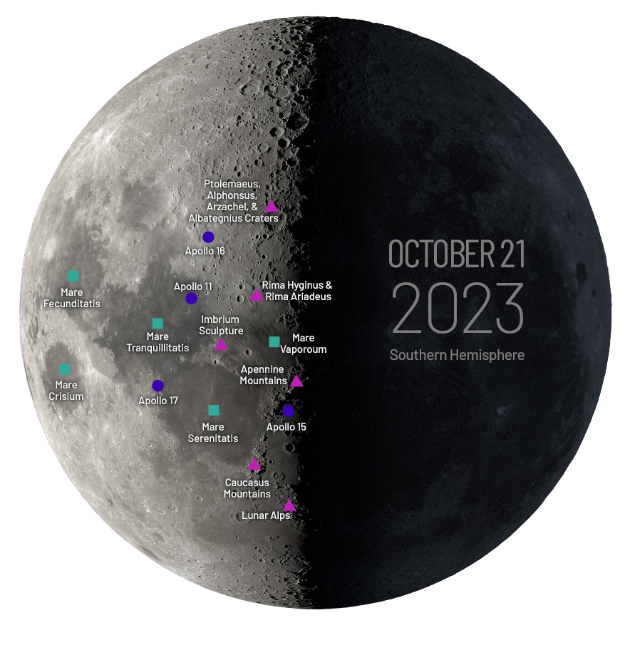
This map depicts the Moon as it will appear from the Southern Hemisphere on October 21, 2023, the date of International Observe the Moon Night. Many of the best views will occur along the terminator (the line between the day and night side of the Moon).
Basalt covers a majority of this mare, which features the crater Posidonius on its northeast rim. Apollo 17 astronauts landed near the eastern edge of the Sea of Serenity on December 17, 1972.
Mare Tranquillitatis (Sea of Tranquility)
Famous for being the site of the Apollo 11 landing and moonwalk, the Sea of Tranquility is rich in metals, including titanium, thought to be created when an ocean of magma that once covered the surface crystallized.
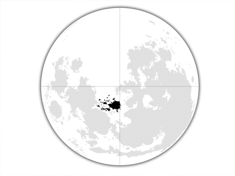
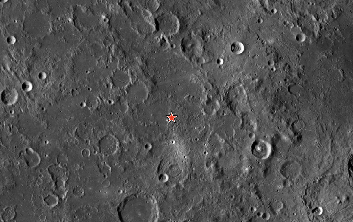
Mare Fecunditatis (Sea of Fertility)
The Sea of Fertility impact basin was the site of the first automated sample return, taken by the Soviet Luna 16 probe in 1970. This mare is a little over 500 miles (804 km) in diameter but less visually distinct than other, similarly sized lunar mare.
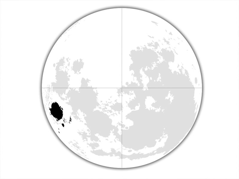
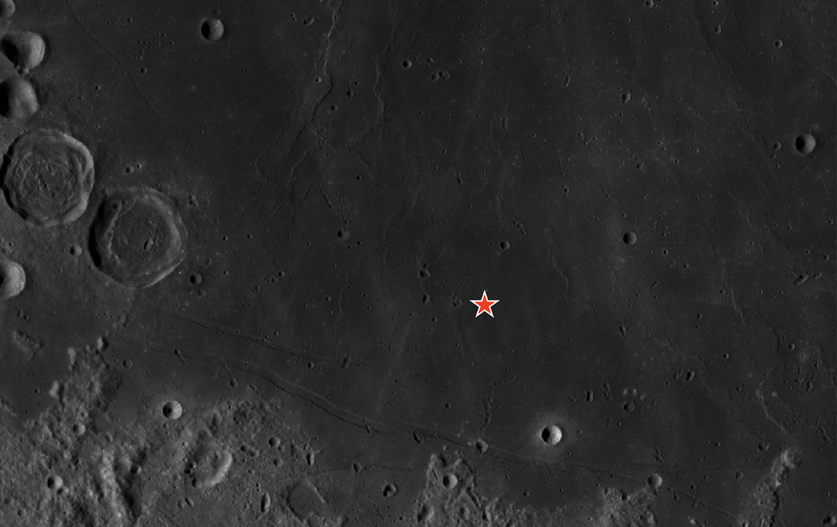
Mare Vaporum (Sea of Vapors)
The "Sea of Vapors" is a small, circular mare that contains one crater, Manilius, at its eastern end.
Mare Crisium (Sea of Crises)
The "Sea of Crises" covers over 109,000 square miles (176,000 sq km) of the lunar surface ― about the size of Nevada.
This mountain range is formed by the northeast rim of the Imbrium Basin, with the plains of Mare Frigoris to the north. Cutting across the mountain range is the Alpine Valley, a graben formed by a strip of lunar crust that dropped down between two parallel faults. Peaks of the Alps rise up about 3 kilometers. The Alpine Valley is 166 km long and 10 km wide.
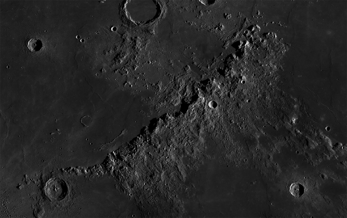
Caucasus Mountains (Montes Caucasus)
This mountain range rises on the eastern rim of the Imbrium Basin and the western rim of the Serenitatis Basin. Towering peaks in this rugged landscape rise to heights of about 4 kilometers. On International Observe the Moon Night 2023, the entire range will be illuminated by the early morning Sun on the Moon. This excellent lighting should provide dramatic views.
Apennine Mountains (Montes Apenninus)
The most spectacular of the Moon’s mountain ranges stretches for 600 km along the southeast rim of the Imbrium Basin. Its peaks rise to heights of about 5 kilometers. Lunar sunrise will be advancing along the peaks and ridges of the range on International Observe the Moon Night, with only the northern portion illuminated.
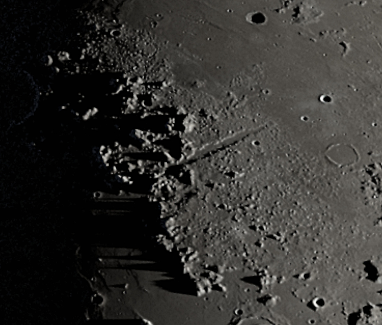
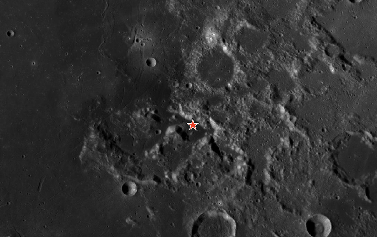
Imbrium Sculpture
The Imbrium Basin formed 3.9 billion years ago in an incredibly violent impact. Evidence of this impact within the basin was buried by the flood of lava that formed Mare Imbrium. But outside the rim, dramatic evidence of the impact can still be seen. To the southeast of the basin, vast deposits of ejected debris and gigantic gouges in the Moon’s surface give spectacular testimony to this event.
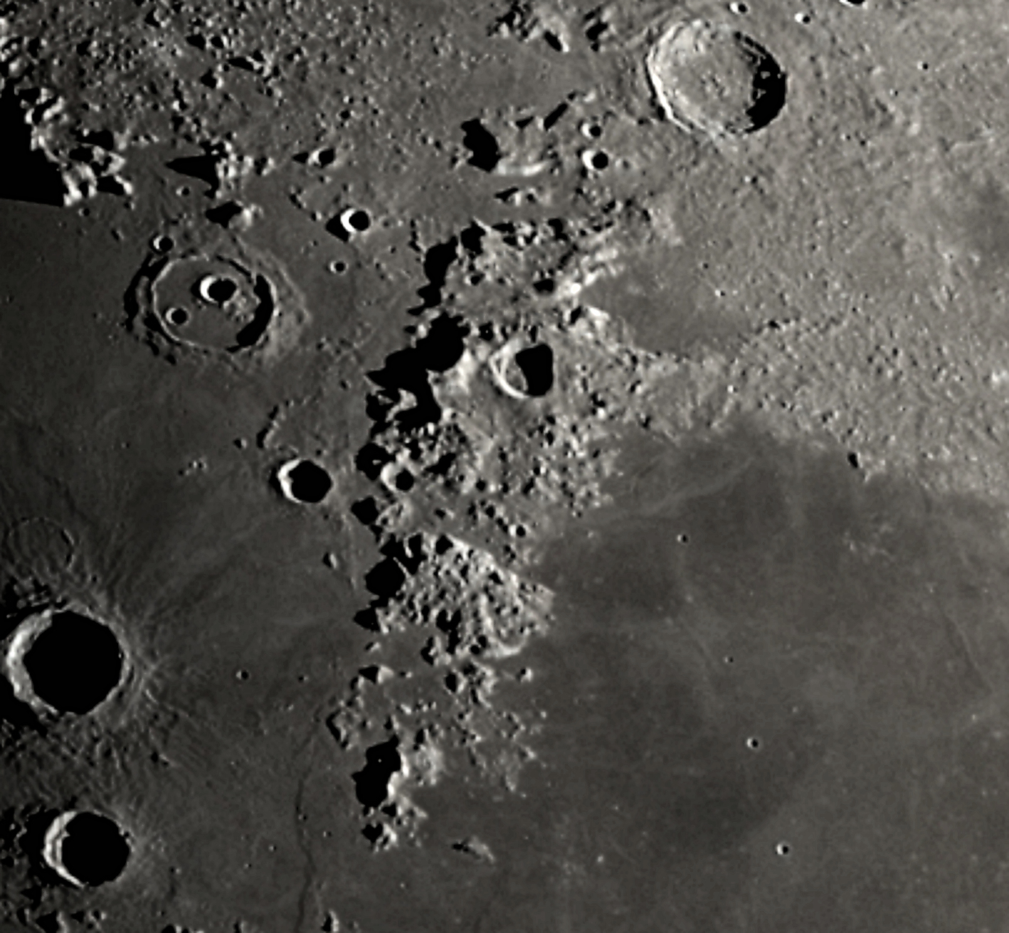
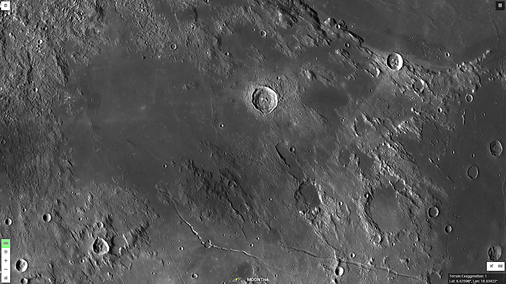
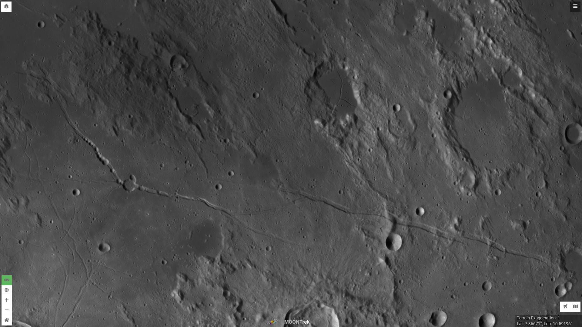
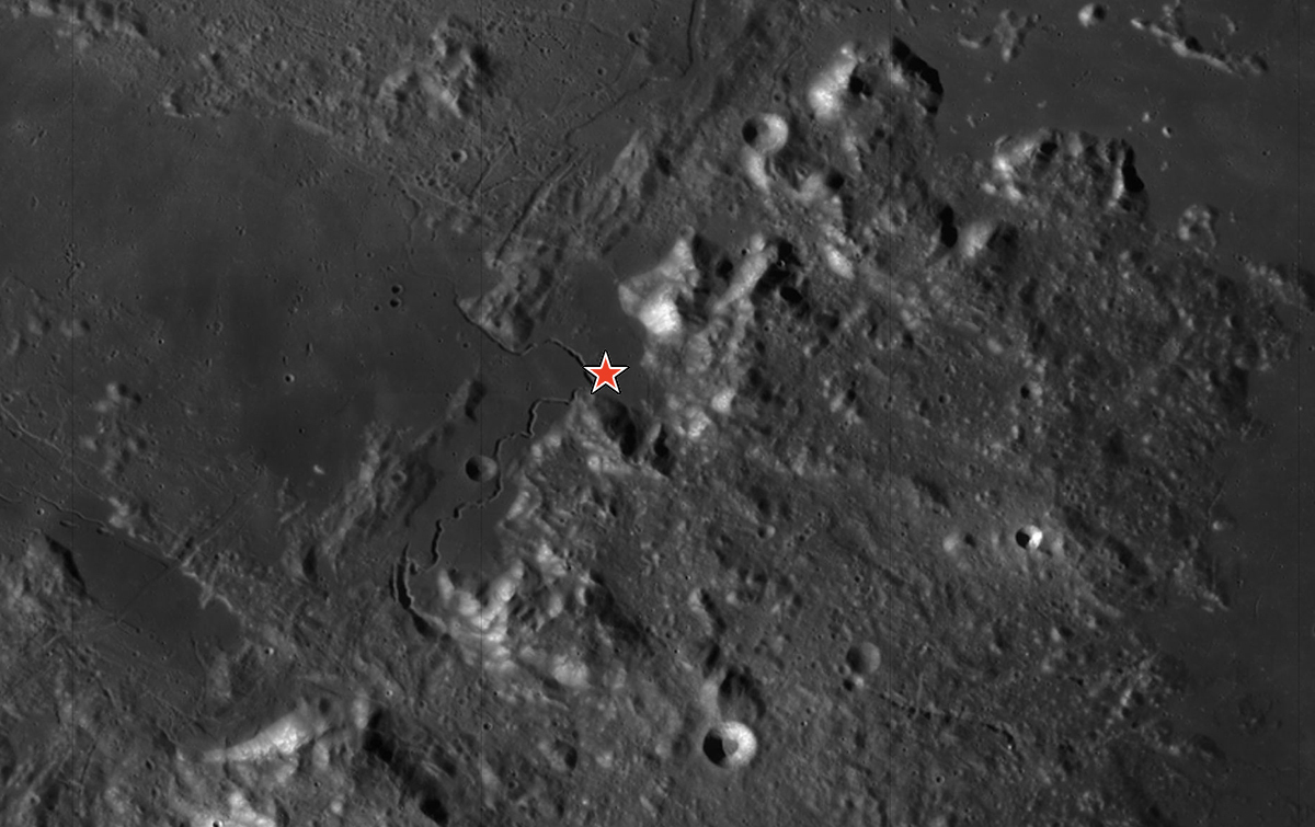
Rima Hyginus & Rima Ariadeus
Amidst the chaos of the Imbrium Sculpture are two great, prominent, apparent fractures in the lunar crust. These are excellent examples of straight rilles formed by magma rising up through and widening cracks in the lunar crust. Hyginus lies to the west and Ariadeus to the east. Magma apparently reached and erupted onto the surface along Hyginus with blankets of volcanic ash around the rille and volcanic pit craters along the rille.
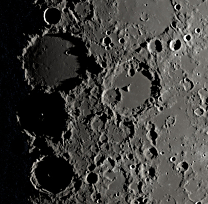
The lunar sunrise on these large impact craters should put on a spectacular show. Watch the dark shadows of the eastern rims retreat across the crater floors and see the heights of the western rims catch the rays of the rising Sun. Look for Alphonsus’ central peak to appear as a bright star as the Sun rises. Ptolemaeus, Alphonsus, Arzachel are aligned north to south and Albategnius is to the east.
The first human landing site was on the smooth flat plains of the Sea of Tranquility. Despite how flat the area looks from Earth and from lunar orbit, astronauts Neil Armstrong and Edwin Aldrin had to maneuver their lander at the last minutes of their descent in order to avoid a field of giant boulders.
Apollo 15
In July 1971, astronauts David Scott and James Irwin landed at the edge of Mare Imbrium at the base of the towering Apennine Mountains. Driving their rover across the mare and up the lower mountain slope, they gathered samples from the dark plains and the surrounding, light-colored lunar highlands.
Apollo 16
This was the first and only mission to land in the rugged lunar highlands. In April 1972, astronauts John Young and Charles Duke collected rock samples more than 4 billion years old. These showed that the ancient lunar crust formed from rock that crystalized and floated to the top of a global lunar magma ocean.
Apollo 17
The final Apollo mission to land on the Moon visited the spectacular Taurus-Littrow Valley, deeper than Earth’s Grand Canyon. In December 1972 astronauts Eugene Cernan and Harrison Schmitt (the first professional geologist on the Moon) explored an active fault scarp, a gigantic landslide deposit, and brought back samples that included beads of volcanic glass erupted in an ancient lunar fire fountain.
Note: Detailed images are from NASA's Lunar Reconnaissance Orbiter. Find more high-resolution images of the Moon at NASA's MoonTrek.