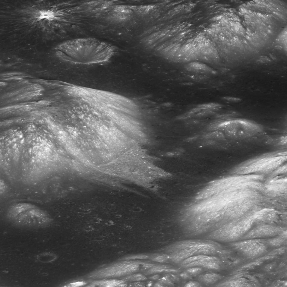
Taurus-Littrow Valley

| Credit | NASA/GSFC/Arizona State University |
|---|---|
| Language |
|
This view of the Taurus-Littrow valley, a geologic exploration target for Apollo 17, comes from the Lunar Reconnaissance Orbiter Camera (LROC) about NASA's Lunar Reconnaissance Orbiter spacecraft. The center latitude is 20.15°N, center longitude 30.98°E. The image is about 11 miles (18 kilometers) wide.
LROC team scientists, led by Prasun Mahanti, continue their quest to understand the most common class of lunar surface feature: small impact craters. The Moon lacks a protective atmosphere, so objects - mostly bits of asteroids and comets - which would form short-lived meteors or bright fireballs high in Earth's atmosphere survive to strike the Moon's surface and blast out craters. Millions upon millions of small craters pock the lunar surface.
In a paper published in the planetary science journal Icarus, the Mahanti team reported results of a study of small crater populations at two Apollo sites. The Descartes study area. centered on the Apollo 16 landing point located at 8.9734°S latitude, 15.5011°E longitude, is a highlands site astronauts John Young and Charlie Duke explored in April 1972. The Taurus-Littrow study area, centered on the Apollo 17 landing site at 20.1911°N latitude, 30.7769°E longitude, is a valley on the edge of Mare Serenitatis that astronauts Gene Cernan and Jack Schmitt explored in December 1972.
LROC has imaged the Apollo 16 and Apollo 17 sites several times under different lighting conditions. So sharp are LROC images that scientists can see the shadows cast by the American flags the astronauts planted at the sites. These images enabled Mahanti's team to examine in great detail craters measuring from 35 to 200 meters wide. The scientists studied 2568 craters at Descartes and 2543 craters at Taurus-Littrow in that size range.
The LROC scientists compared and catalogued the shape of small craters to better understand how erosion takes place in the top few meters of the regolith (soil). They grouped the craters into three basic classes. "A" craters are the least degraded, with sharp rims and bowl-shaped interiors. "C" craters are the most degraded, with no rims and shallow, funnel-shaped profiles. "B" craters fall in-between. They have rims lower than "A" craters and are more bowl-shaped than "C" craters. The shapes indicate how much erosion has taken place.
